This is the quasi default mode of the GIS Editor. The cursor changes to a move shape
 when touching the background map. The map is "frozen" and exists as an image sample
on the sample list. Changing the map region or resolution is no longer possible.
But the Shift Mode provides 2 features:
when touching the background map. The map is "frozen" and exists as an image sample
on the sample list. Changing the map region or resolution is no longer possible.
But the Shift Mode provides 2 features:
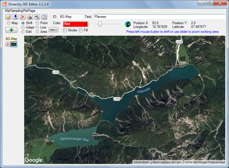
Press and hold the left mouse button and move the mouse to shift the working area within the display window. This is useful when having loaded a map from a storage unit which is larger than the GIS Editor's window, or in combination with zooming the working area.
Place the mouse cursor at the slider control, press and hold the left mouse button and move the control left to zoom out or right to zoom in the working area. The range of the zoom is from factor 0.6 to 3.0. The current value is displayed beneath the zoom control. Double click the slider control to reset the zoom to default value 1.0.
Enlarging the working area makes it more easy to place objects precisely. The relevant area then could be selected by moving the zoomed working area. Downsizing the working area gives an overview of large map regions.
Note that the resolution of the map itself does not change any more when zooming in. But objects on the map are created in vector graphics, so the markers, lines or areas will remain sharp and clear while zooming. And they will adapt there thickness smoothly to the size.